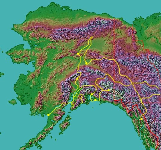
Our trip took us from Rutland, Vermont, across Canada to the Alaska Highway and into
and around Alaska. We then returned through British Columbia, flying
through Banff and Jasper before stopping in Glacier National Park in Montana, then
flying across the northern US back to Vermont. The total distance travelled
was over 10,000 miles. The sequence of pictures is as
follows, and each page will link to the next one.: 1. The Set-up 2. Getting There 3. McCarthy and Kennicott 4. Cordova 5. Valdez and the Shoup Glacier 6. King Salmon and Katmai Park 7. McKinley, Manley Hot Springs and Fairbanks 8. Juneau 9. Miscellaneous Photos - Part 1 10. Misclelaneous Photos - Part 2 11. Information Page Click on the list above or on any of the links on the map to join the trip sequence. |
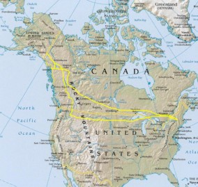
Route of Flight - Vermont to Alaska and Back |
12/15/04 |

Route of flight shown in yellow |